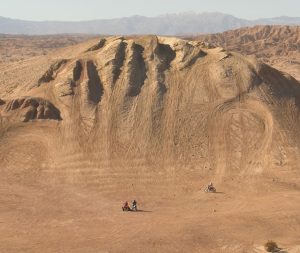
2022 Fremont Peak
Our annual New Years ride is coming up. The first arriving RUTS members will mark camp in with RUTS arrows from 20 Mule Team Road and Highway 395.
See MAP links below for camp location
Our club ride scheduled for:
Wed Dec 28th through Sun Jan 1st
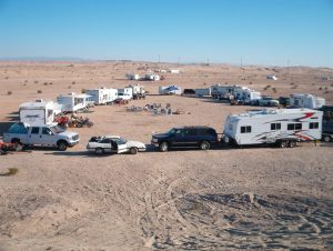
We will be camped at the first dry lake bed behind Fremont Peak (not Cuddyback), in the same location we have used for past few years. (last year was an exception in a new rain alternate location)
We will have planned rides to the Husky Monument, Inscription Canyon, Randsburg, The Squid Pit, The “Gold Fish” pond and an “Around the Peak” single track advanced ride. We will have a Saturday night potluck dessert, and Sunday morning “Church in the desert”.
Friday: Ride to inscription canyon, Husky, Randsburg and or the Gold Fish pond.
Saturday: more rides….Potluck Dessert after dinner. (7pm)
Sunday: Church in the desert. 8am
Single track “Around the Peak”, early morning and or late afternoon. Friday and Saturday.

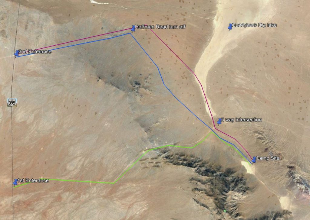
Camp location
GPS: 35° 13.258’N 117° 26.582’W
Google Earth (KMZ):http://tinyurl.com/RUTSnewyearscamp
Google Maps: http://tinyurl.com/RUTSnewyearscamp2
PDF Map: http://tinyurl.com/RUTSnewyearscamp3

DIRECTIONS. Take highway 395 NORTH from Kramer Junction (395/58) for 18.5 miles Turn RIGHT onto Cuddeback Road (20 Mule Team Road).
If Cuddyback dry lake is DRY, go 5.2 miles and turn RIGHT again onto a marked road that will go TOWARDS the dry lake. There might be RUTS arrows at this intersection. Go right towards Cuddeback Dry Lake. Once on the lake bed, turn RIGHT. Follow the Lake / road to the 5 way intersection. There may be more arrows at this intersection. Go THROUGH the intersection, and continue approximately 2 more miles to the un-named dry lake at the base of Fremont Peak Mountain. RED LINE ON MAP BELOW
RAIN ALTERNATE, go EXACTLY 4.6 miles on Cuddyback Road, and turn RIGHT onto Hoffman Road, the road will take you all the way to the 5 way intersection. There will be more arrows at this intersection. Go THROUGH the intersection, and continue approximately 2 more miles to the un-named dry lake at the base of Fremont Peak Mountain. BLUE LINE ON MAP BELOW
Traditional Route, via Fremont Peak road. Reports are that this road is in better shape this year then in years past. No major puddles, unless it rains the days before our camp trip. Do NOT expect RUTS arrows on this route. Only go this route if familiar with the location. New attendees should go the route via Cuddyback Road. There is a rough section at bottom of hill coming up to 5 way intersection that is hard on large motorhomes pulling trailers. Trucks and or small trailers will have no problems going this route. From Hwy 395, Turn RIGHT onto Fremont Peak Road, veer left at 3.8 miles. Go 4.5 miles tot eh 5 way intersection. Turn RIGHT and go 2 miles to campsite. GREEN LINE ON MAP BELOW.

Please don’t forget to bring a dessert to share SATURDAY night and also FIREWOOD!
For more information or questions
Check out the RUTS Facebook page
https://www.facebook.com/groups/racersundertheson/
or email ruts@ruts.org
2020 Thanksgiving Ride (NEW LOCATION)
The Mittner family will host this years Thanksgiving Club Ride SOUTH of Ocotillo Wells. Come join us before or after your family dinner. They will be setting up camp on Wednesday . If you arrive earlier, please MARK in your location, so we don’t have two camps on Thursday. Fly a flag, mark on a pie plate or print you up some RUTS ARROWS on card stock! Come out for a low key, relaxing weekend of riding and some campfire fellowship. Camp will be at a NEW LOCATION near Superstition Mountain
Potluck Thanksgiving dinner on Friday! To join the conversation about the ride, click this link to go to our Facebook page.
Directions (NEW LOCATION)
From Interstate 8 (Kumeyaah Hwy), turn NORTH on Imperia Hwy. Go across the freeway then turn right on S80, Evan Hewes Hwy. Go 4 miles to Painted Gorge Road, turn LEFT and go approximately 4.7 miles on Painted Gorge Road. From this location, you can ride to Ocotillo Wells, but it is SOUTH of Ocotillo Wells. For some, it may go THROUGH San Diego. For others, it may go through the Salton Sea.
GPS coordinates:
32.8128°, -115.9720°
The Mittner will be trail-bossing this weekend
Camp will be marked with PINK RUTS arrows
For more information or directions, call Barry Mittner @ (805) 990-7231